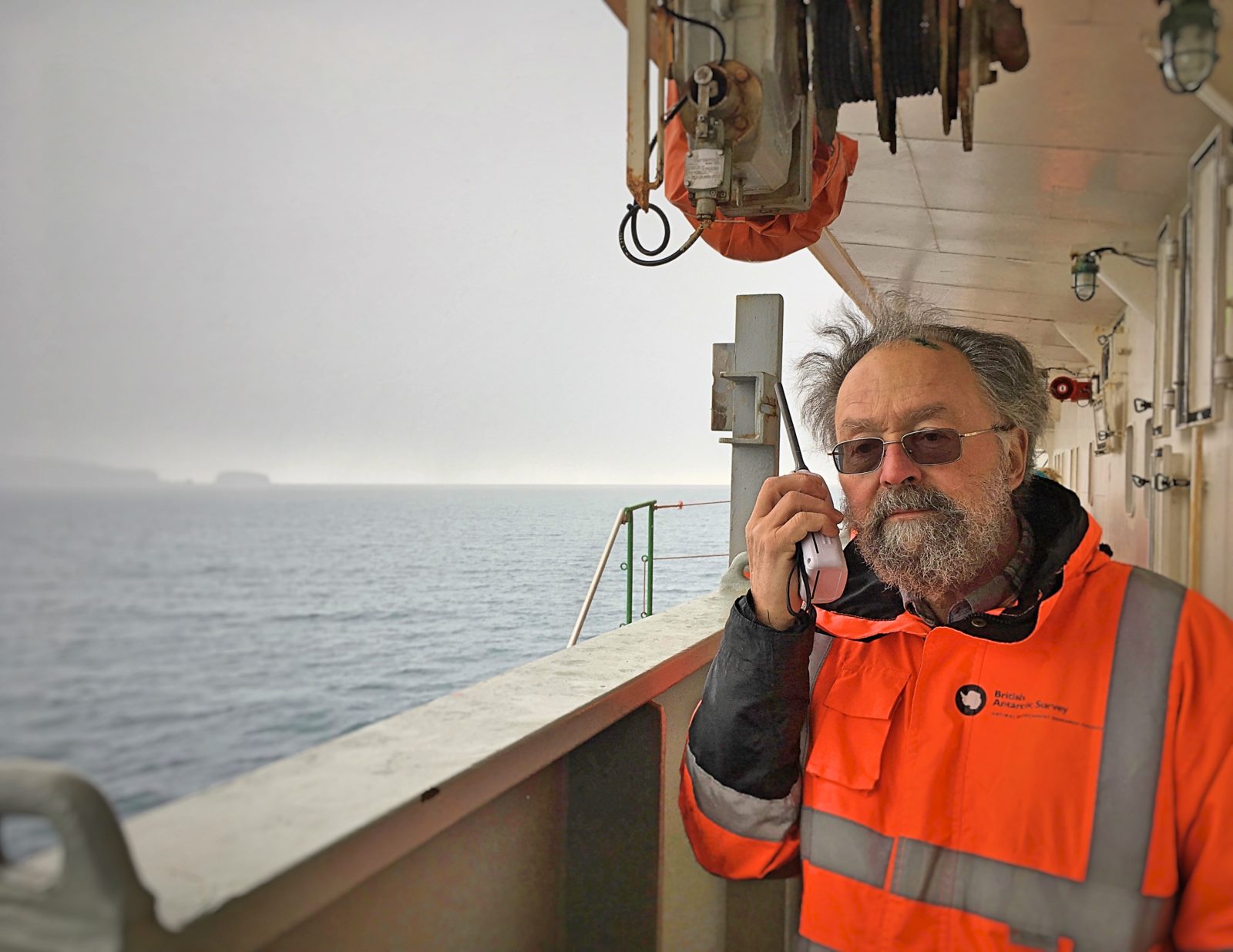
Chief scientist on the ACE expedition and an expert on the White Continent, David Walton shares his thoughts and impressions about the three-month trip and the science undertaken on board.
He knows Antarctica. A scientist with the British Antarctic Survey for 50 years, David Walton has traveled mto the White Continent about 35 times and has visited many parts of it. In 2016, he was chosen by the Swiss Polar Institute, based at EPFL, to be the chief scientist on the ACE expedition. Two months after the end of this incredible voyage around Antarctica (December 2016 to March 2017), he shares his thoughts and impressions.
- How do you feel now that the expedition is over?
I am definitely pleased that we achieved so much. The weather in the Southern Ocean can be really difficult. That was the case on the first leg of the expedition, but it was much better on the second one, which allowed us to carry out more scientific activities than expected. And also, we could go to some unplanned and very unusual places, like Mount Siple. It is normally very difficult to get to because it is generally cut off by pack ice. This time, the ice was gone, so we sailed there right away. And it was fantastic!
- In hindsight, what do you think should have been done differently?
We certainly had too many projects. Trying to run 22 different – and often competing – projects a single ship was really tricky. Of course, there was an up side: we had a tremendous range of sciences on board and a lot of interesting interactions between the different experts. But the downside was that we couldn’t do some of the projects properly and didn’t get as many samples as some people would have liked. We simply didn’t have enough time to share between everybody.
- What was the biggest challenge during this trip?
To ensure that we used as much time as possible for sampling and to reach each of our three ports on time. As chief scientist, I had to gauge situations within a very short time-window, not only to guess exactly how much time we had before the next change in weather or current, but also to estimate how long each operation would take. A station*, for example, could last anywhere from 2 to 9 hours depending on wind and sea conditions. You cannot allow too many mistakes on an expedition like this, which is why changing the plans all the time is actually very hard work.
- …and the most rewarding?
Seeing Heard Island without the clouds… This island lies under a persistent cloud cover 362 days a year. So, it’s really rare and special to see it clearly like that. And so it was with the Balleny Islands, seeing them without clouds – and without ice too. I have been there before, but never in such good conditions.
- You have spent your entire career in Antarctica. How many times have you been there?
I have been working in the Antarctic for fifty years and have been there about thirty-five times, beginning with South Georgia in 1967 as an ecologist for the British Antarctic Survey. I worked in collaboration with other countries in different places, like the Antarctic Peninsula and the Ross Sea. I was mainly involved in ecological questions, like plant communities and colonization issues. I became responsible for managing programs and organizing their funding. I also acted as a consultant in Antarctic policy and even started an Artists and Writers Program to gather interest from the Humanities. I have done a lot of different things, including more recently lecturing to tourists on cruise ships on science, politics, and history.
- What is your favorite part of Antarctica and why?
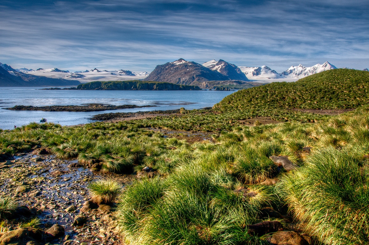
South Georgia, because of its wildlife, the richness of its fauna, its landscapes, its mountains. This is really one of the most beautiful places in the world.
- During your career, have you personally observed climate change in the region?
Yes, absolutely. If I look at the pictures I took there in the sixties – especially the ones of South Georgia – the difference is striking. The glaciers’ tongues in the bays used to float on the sea. Now, they have retreated back up to one or two kilometers back on land. Further south, on almost every island and on the Peninsula, you can see new bare areas. There has been an astounding loss of ice.
- Scientifically, what does this expedition bring to climate changes studies?
There are several «firsts». ACE is unique in gathering samples during a full tour around the continent and doing so during a single season, and also in combining terrestrial, marine and atmospheric data. Plus, we have learned that many of the ship’s projects fit perfectly together, providing an unprecedented, more integrative view of the way things are happening in the Antarctic. Thus, ACE can shed new light on the interactions, for example, between the food web and the sea, the aerosol particles in the atmosphere and the way clouds are forming, or the snow precipitations and the nature of the ice, etc. That is why one of ACE’s biggest objectives is now to get projects to work closely together.
- Is taking these interactions into account a new aspect of scientific research in Antarctica?
Well, other scientists are trying it all the time, but generally speaking, these trips are dedicated to a relatively small number of science areas. There was a particularly broad range of fields involved in this expedition, which offered new opportunities to cross not only disciplines but also cultures, because of the many nationalities and countries represented aboard the Akademik Treshnikov, each one of them organizing and managing their science differently.
- This expedition is also unique as an opportunity for young scientists…
Yes! The maritime “university” we ran before the first leg of the expedition was an important activity. We took the opportunity to use the Treshnikov and its journey from Germany down to South Africa to welcome 49 students onboard, who now have a much clearer understanding of what it means to be a marine researcher. Equally, we had a lot of PhD students and postdocs on the three legs of the trip. Having so many young people around, and not being dominated by the «oldies» was one of the most delightful aspects of this expedition. Plus, we saw genuine interest and enthusiasm on their part and I hope we’ve played a small part in persuading some of them that a career in Antarctic science is a worthwile and exciting activity.
- What do you expect from organizations like the Swiss Polar Institute?
First of all, they can provide a central link between all the scientists interested in working in Polar Regions. Secondly, thery can give birth to new ideas in terms of how science is done, be it through more expeditions or even joining activities with other countries with concerns in the Antarctic or Artic. And finally, I think such organizations must be able to incorporate some of the important new tools that are used elsewhere in science, like open access to data and published papers. We should not just aim to make the science more accessible but also find ways we can make it more visible and relevant to the public.
- Does Switzerland have a role to play in polar questions?
Every country has a role to play in explaining to its citizens why Antarctic research is important. In some conferences, I talk about the impact Antarctica has on our climate and our oceans and why this is crucial, for example, to people living in coastal areas because of sea levels rising. But this is important to all of us, because we share the same atmosphere, which contains increasing amounts of carbon dioxide, and the Southern Ocean is the single largest sink for it.
- What is your next project? Will you go back to Antarctica?
Yes, I will go back next December. But it will be something totally different: on a cruise ship, talking to tourists about why the Antarctic is important. It is another way to inform the public and a good opportunity to recharge those polar batteries!
Interview by Sarah Perrin
*Operation during which the ship stops for the deployment of the “rosette”, a device carrying several bottles and sensors to sample and measure different parameters of the water at various depths.