On-going glacier retreat will change the ways glaciers erode bedrock and subglacial water carries sediment below the glacier. Changes to sediment discharge from glaciers in mountainous or inhabited regions such as Switzerland can impact the delivery of sediment to ecosystems, lead to the infill of hydropower reservoirs, and potentially cause increased wear on hydropower infrastructure by hydro-abrasion. On remote ice caps and ice sheets, such as the Greenland Ice Sheet, where less infrastructure lies near the ice, changes to sediment discharge impact the interaction between the ocean and glaciers and affect the delivery of sediment into the ocean, which can influence nutrient cycles. Furthermore, as glaciers retreat, they often leave an expanse of loose and unconsolidated sediment with little soil or vegetation. These proglacial areas and rivers can be rich sources of sediment when water moves quickly and can be a sink for material when water moves slowly and deposits sediment. Deposition and transport in this area may act as a buffer in transmitting sediment from the glacier to the ocean.
In late May and early June of 2021, Bruno Belotti and I visited Akuliarusiarsuup Kuua (Watson) river near Kangerlussuaq with the objective of installing instruments to measure the quantity of sediment leaving the ice sheet and the processes acting upon sediment between when it leaves the glacier and when it arrives at the ocean. At Kangerlussuaq measurements of sediment discharge have been kept from 2006 to 2016. Measurements of sediment discharge covering such a long period of time remain rare and prove useful in understanding the response of sediment transport to recent glacial changes. Because river systems often lack a sediment trap, like a lake or fjord where sediment cores can be collected, continuous measurements such as these are needed to record the quantity of sediment leaving the system.
To accomplish this task, Bruno and I re-installed a turbidity meter at the bridge in Kangerlussuaq and collected water samples to calibrate the measurements from the sensor. Water from four glaciers draining the Greenland Ice Sheet flows under this bridge. In summer, water discharge, measured by the Geological Survey of Denmark, through the bridge can exceed 2000 m^3 s^-1. For comparison, the Aare’s discharge reached about 500 m^3 s^-1 this summer and the Rhone river flowed at 400 m^3 s^-1 as it leaves the Rhone Valley into Lake of Geneva. It is a lot of water. When we multiply the sediment concentration by the water discharge, then we know the flux of sediment leaving the catchment at a moment. Then we can add these values over the entire season to know the quantity of sediment leaving the area over one year.
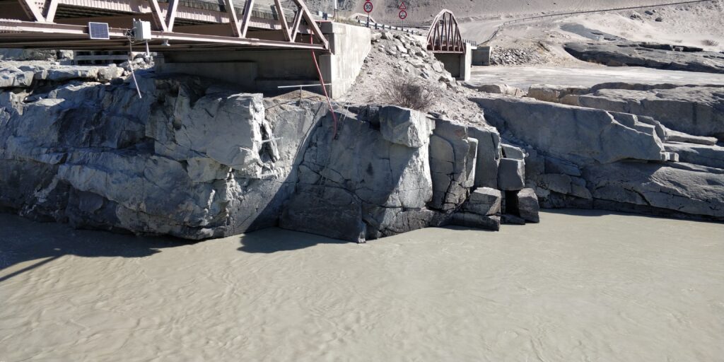
The bridge in Kangerlussuaq is one of the few locations in the area where the river flows through a bedrock channel stable enough to build a bridge on. Thus, it remains a unique and ideal site to collect water and sediment discharge measurements.
Even so, pits in bedrock surrounding the bridge caused from hydro-abrasion by sediment-laden meltwater can be seen around the bridge.
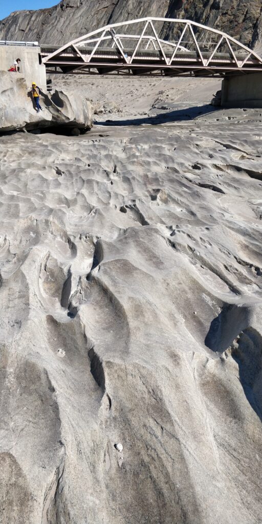
While continuing the record of sediment discharge from the catchment remains a top priority, it is also very important to understand the river processes that occur between the glacier and the bridge. These processes include the deposition of some material along the river backs and the re-mobilisation of other material deposited in the past. Thus, the measurements at the bridge in Kangerlussuaq do not necessarily represent the amount of sediment leaving the glacier at roughly that time.
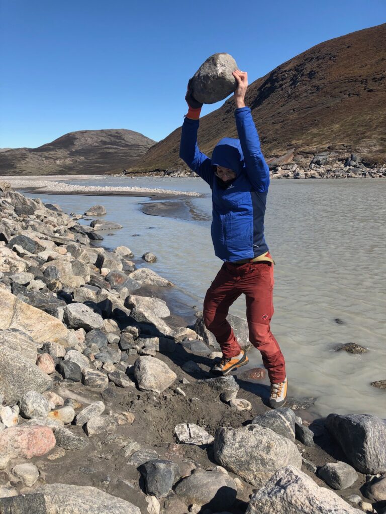
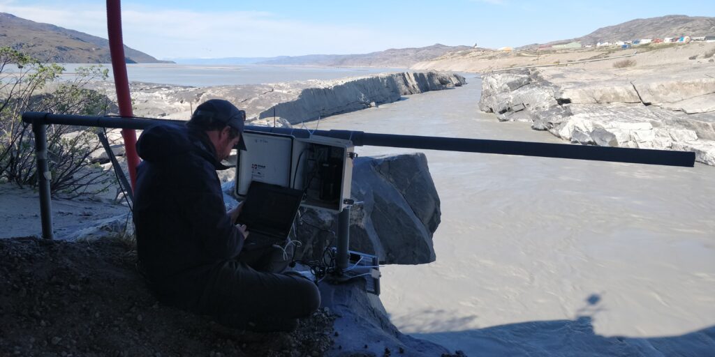
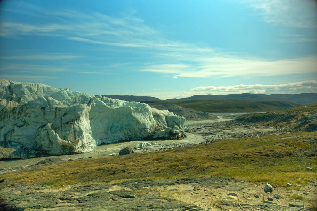
To account for these processes, we installed turbidity meters and seismometers near the Russel Glacier. Not all of the water at this location comes from the Russel Glacier. However, installation at another glacier would not have been possible without a far more extensive field trip. Seismometers measure the amount of sediment carried along the river bed by measuring the force of the impacts of bedrock bits on the river bed.
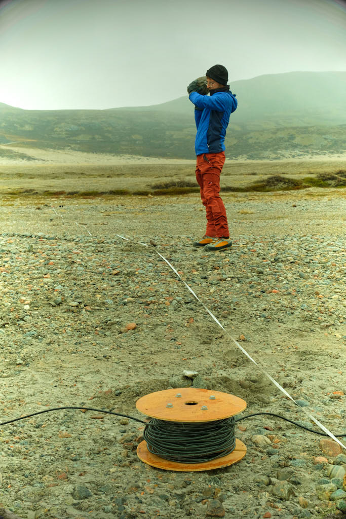
By installing these instruments at several points along the river, we can begin to understand the amount of sediment deposited and remobilised between the glacier and the fjord.
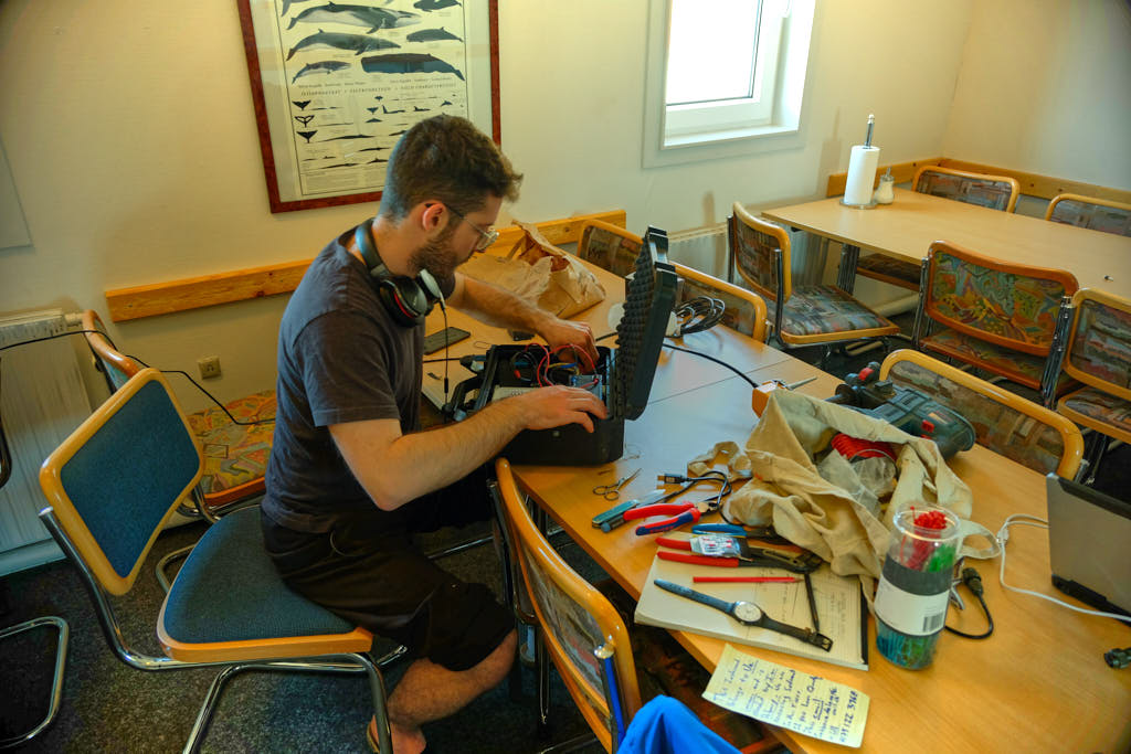
Naturally, with this much electronics, some technical difficulties arose. Bruno’s clear thinking enabled us to fix these instruments and get them installed. He is also quite an adept cook.
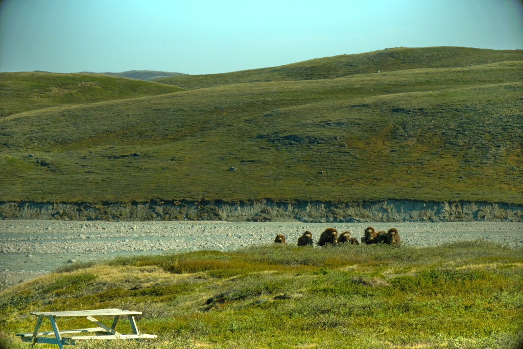
Sediment and glaciers were not the only interesting things to see here. We saw several muskoxen and reindeer as well, however, we thought it best if we kept a healthy distance and left them to their grazing.
Our instruments are currently running and collecting data over the summer. They will be collected in September and re-deployed next season in 2022. Hopefully, this information can yield some important insights into the quantity of sediment leaving the catchment, as well as sediment transport processes that occur between when material leaves the glacier and enters the ocean. Furthermore, similar measurements of suspended and bedload have been carried out at alpine glaciers, with much smaller water discharges and larger diurnal variations in water discharge. The data here may help to understand the different processes affecting sediment transport from these glaciers.
I consider this some quite unique data, and it will be exciting to see what we learn. As a result, I am very grateful to the Swiss Polar Institute for providing funds to realise this research.
Ian Delaney is an early-career researcher at the University of Lausanne. His field trip took place in May and June 2021 with financial support from a Polar Access Fund grant.
Header photograph: © 2021 Ian Delanay, all rights reserved