Numerical models for glacier hydrology rely on sound input data for calibration and validation. In particular when upscaling these models for regional-scale assessments of water availability in glacierised catchments, this is of great importance and includes data on various hydrological components, such as rain, snow, ice and permafrost. Understanding which processes are at work and with what intensity they eventually result in river runoff is of great importance for improving the numerical representations to make sound assessments of current and future water availability in the region. This importance was recognised a long time ago and resulted in the establishment of glaciological field sites at key glaciers across Central Asia during the Soviet Union. Field observations would include ablation and accumulation stake measurements to calculate the glacier mass balance (how much ice and snow a glacier is losing or gaining).
In Central Asia, however, the remote locations of glaciers and demanding logistics, together with poor funding, resulted in the degradation of glaciological and hydrological networks following the end of the Soviet Union. Multi-national initiatives have started forming a bit more over a decade ago to (re-)establish these measurement networks. The participation of members from the World Glaciological Monitoring Service (WGMS) has directed the focus of the re-establishment towards glacier mass balance monitoring.
While glacier mass balance monitoring is providing valuable insights on the evolution of the glaciers themselves in the region, they lack the ability to reveal intra-annual melt dynamics and to relate mass balance with resulting runoff. CoWaG aims to close this knowledge gap through the installation and calibration of automatic water discharge gauges in streams in the direct vicinity of the monitored glaciers (pro-glacial). This shall allow investigating the relationship of glacier evolution and resulting available fresh water in different climates across Central Asia, where people strongly rely on river water for irrigation and drinking water.
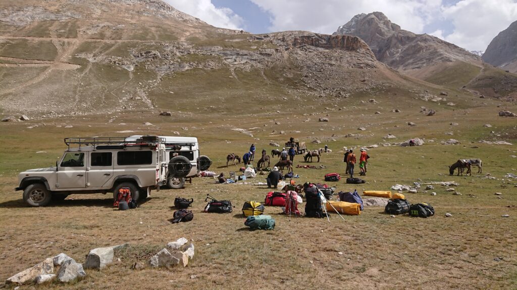
Due to COVID travel restrictions, travel to field sites in Central Asia was postponed, but finally happened in 2021 with a great team of scientists from the University of Fribourg as well as from our partner institutions in Central Asia. At five out of eight planned glacier sites, my team and I installed water level gauges and performed their calibration using fluorescent dye tracers.
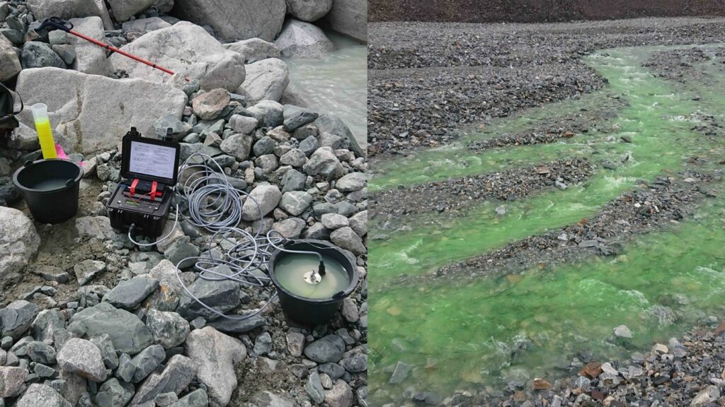
This is of paramount importance to relate the automatically (one-hourly) registered water level to actual discharge. For the dye tracer experiments, a known amount of tracer is injected into the pro-glacial stream and its concentration over time is measured some hundred meters downstream where the dye is well-mixed in the stream water. As the dye plume is travelling past the measuring point, the change in dye concentration is monitored to obtain a concentration curve (evolution over time) with a fluorometer. A sufficient distance between injection and measuring point is required to allow for thorough mixing in the water; i.e. anywhere in the cross-section of the river at this point, the concentration is the same.
This method is particularly well-suited if the channel geometry (i.e. how the river cross-section looks underneath the water surface) cannot be measured. This is the case, e.g. if the river is too deep or too wide to wade through or if there are large blocks in the stream that introduce a lot of spatial variability. Finally, it is possible to calculate the water discharge from the concentration curve by some rather simple mathematic operations.
A total of 58 measurements were conducted in this way and several kilometers of walking were involved to inject the tracer upstream. In some cases where water flowed under the surface or there was a complex network of streams, the water level gauges had to be installed further downstream.
We could not install all instruments due to a bridge being swept away by extraordinary rainfall in the mountains and because of a transnational conflict between Kyrgyzstan and Tajikistan, which we hope will be settled next year. Until then, we assist our project partners in Tajikistan and work closely together with the WSL, who is also aiming to set up instrumentation at a key site for one of their projects in the Tajik Pamirs.
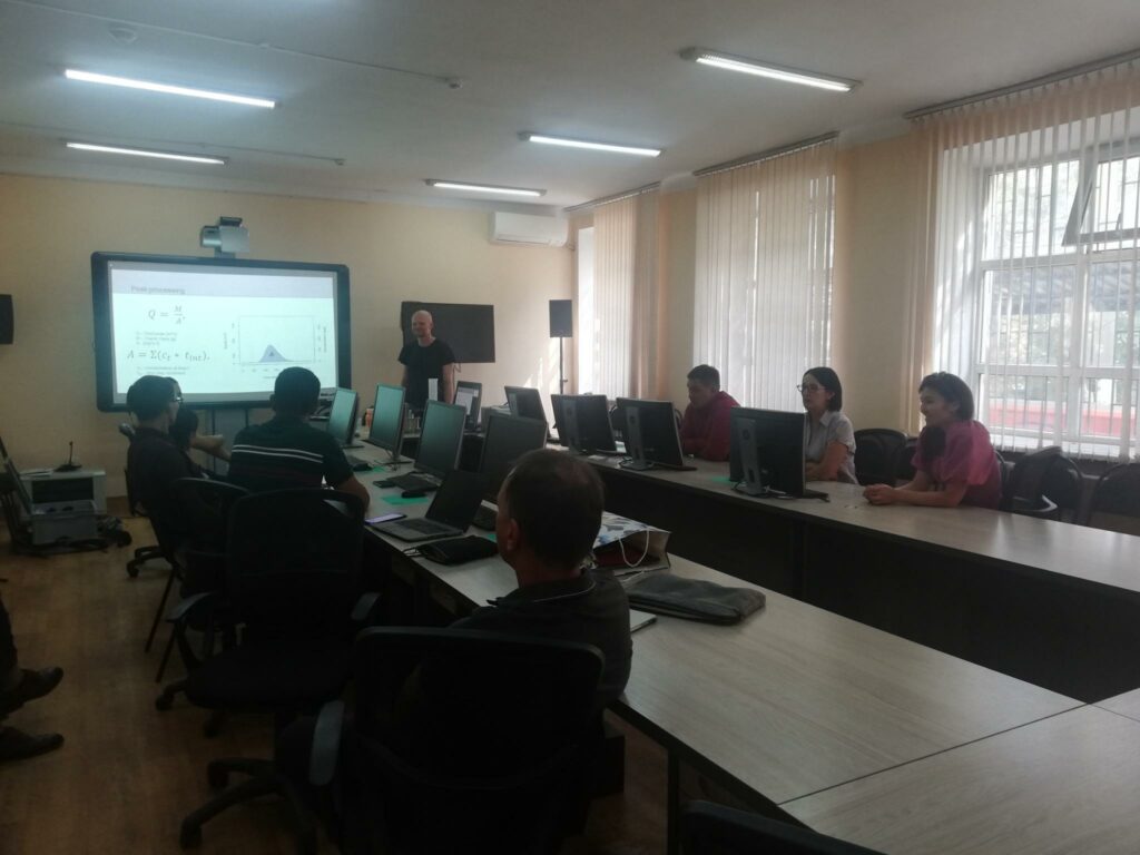
Local partners in Kyrgyzstan were trained in the field and two workshops at the Central Asian Institute for Geosciences, as well as at Kyrgyz Hydromet shall win more partners for this effort that hopefully will continue with a SNSF funded project.
Eric Pohl is an early-career researcher at the University of Fribourg. His field trip took place in summer 2021 with financial support from an SPI Exploratory Grant.
Header photograph: Installation of water level gauges requires searching for good spots where the instruments can be safely fixed for a full year before retrieving the data; and no fear of cold, 2ºC water. © 2021 Eric Pohl, all rights reserved