Ice mass loss from Greenland has accelerated over the last few decades and it has recently been predicted that Greenland could become ice free in the next millennium. During past interglacial periods, when global mean temperatures reached values larger than today, the Greenland Ice Sheet was most likely smaller than its current extent. This research project aims at constraining the extent of the southern Greenland Ice Sheet during past interglacial periods, to reveal its sensitivity to past climate changes. We want to measure the content of cosmogenic isotopes (10Be, 26Al and 14C), formed within minerals by the collision of cosmogenic ray particles with the surface of the Earth, during periods of exposure (limited ice extent). For this purpose, we collected sediment samples during fieldwork, from which we will isolate quartz and measure the isotope content.
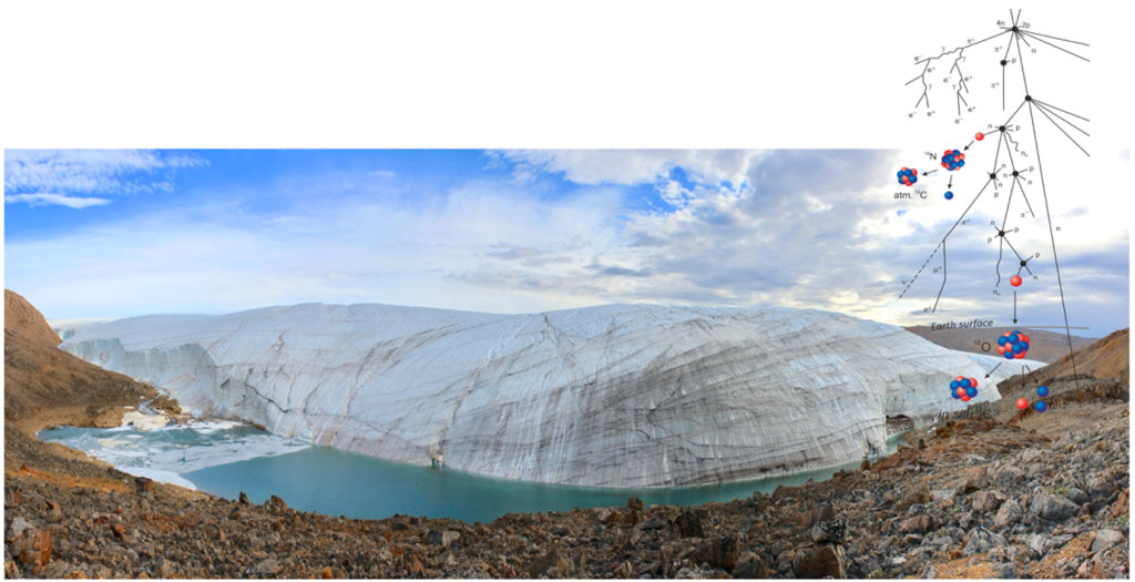
Combining isotope concentrations with inverse modelling can give us a model output which shows the most likely ice extent during past interglacial periods. We will combine the model output with geological mapping and field observations to support interpretation of the sample results, and hope to obtain new and extended knowledge on ice cap sensitivity to climate changes during interglacial periods.
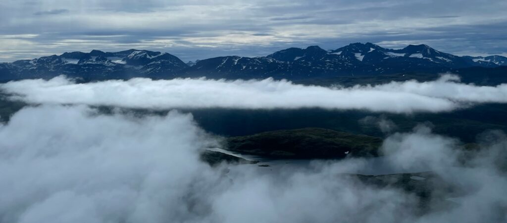
With the hope of bringing 10-15 sediment samples home with us, we set out for Greenland in July 2022. We were a group of 4 scientists based in Switzerland and Denmark that would work together on various projects during our 8 day long stay in southern Greenland. We flew to Narsarsuaq from Denmark and then on by helicopter to Qaqortoq, where we would be based. Already on our arrival we could see lots of low hanging clouds and heard people talking about a very foggy and cloudy summer, so it was with a bit of tense mindset that we started planning the days in the field.
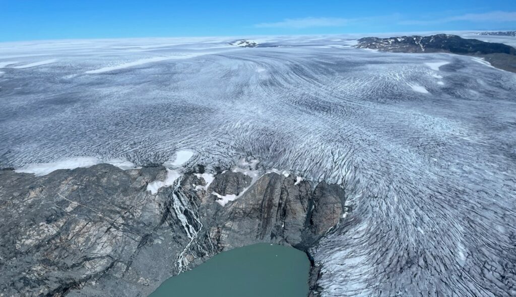
We had booked three days with a helicopter within a 6 day time frame, and were supposed to set out the day after our arrival, but the clear note from the pilot when we met with him was that it did not look good. And indeed, the first two days ended up being one long waiting-position for better weather but without luck. In general, it looked better along the ice sheet margin as opposed to between fjords and mountain areas, so we ended up deciding to focus on this area. This meant that the initial plan for this project, focusing on local ice caps, had to be abandoned, and instead we chose to go for more local parts of the Greenland Ice Sheet.
Finally, on day three, the weather cleared enough for us to get going, so we packed the helicopter with all our equipment and went towards our first sites. Besides collecting the sediment samples for my project, we also collected rock samples, cut out with a rock saw, so it wasn’t long before the helicopter was full of rocks, dust and happy geologists.
We sampled at different locations, some were very close to the ice sheet margin where we would have direct and easy access to the meltwater and sediment deposits, whereas other places demanded us to go further away from the ice sheet margin to have access to a place to sample our sediments. In some places, the meltwater stream would be very strong close to the ice sheet margin, so we would not be able to take a sediment sample without it being at a risk. In other places there was no meltwater left, which made it easy to collect the sediments, deposited during times of meltwater flow. In most places, it was fairly easy to land with the helicopter, but sometimes we also had to walk a while, as rocky and unstable ground made it difficult for our pilot to touch down safely.
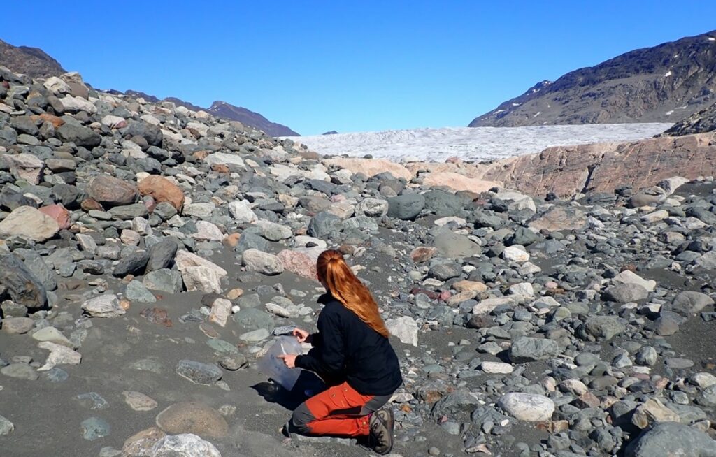
The procedure, after landing at our sample location spot, was to always locate the best possible place for taking a sample. The sediment we needed for the project had to not be at a too coarse fraction as this will make the laboratory process more difficult. It was therefore important to sample in areas where there would have been low energy meltwater streams, as this makes for sedimentation of the finer grained material. In some places there would be a large mix of all grain sizes, and we therefore had to use longer time for shoveling up the finer fragments to avoid too large pebbles in our sample.
In other places the sediment would be very fine grained and it was very easy and quick to take the samples. But besides the weather, which some days challenged our fieldwork, we also had smaller difficulties in the field. In the picture above, you see a sample we took in front of a smaller outlet glacier (seen in the far back). When we started the sampling at this location everything around the sample location was dry, but due to the tides and this place being within a large fjord, the area where we sampled slowly filled with water and we had to hurry at the end to not get our feet wet.
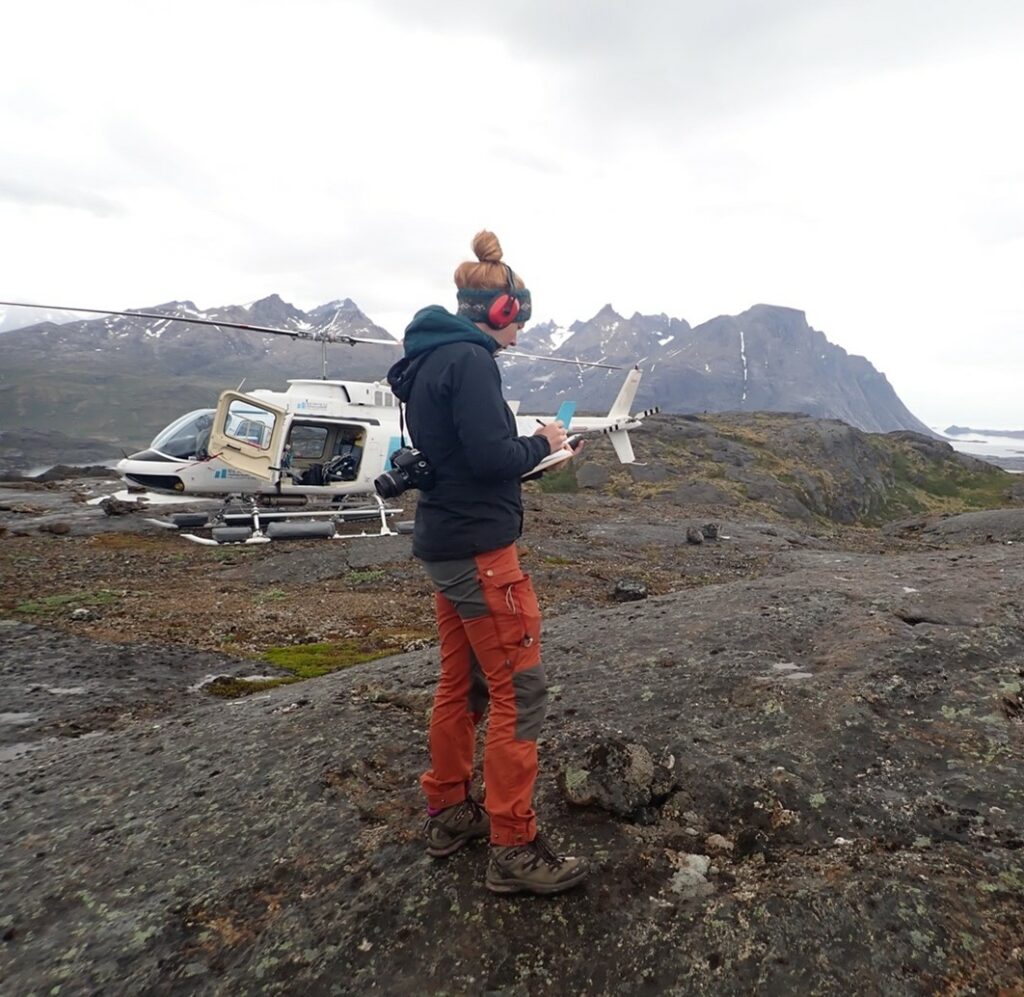
When you are in the field it is important to make fieldnotes about the different locations, samples you collect and anything else that can be important for the scientific interpretation of your results. Here I am, in front of our helicopter, taking notes for my colleagues that collect rock samples. The rock saw they use is very loud so we all needed to wear ear protection.
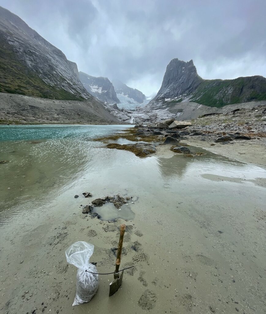
Besides the sediment samples, we also carefully wrote down information about the different sample locations, hereunder latitude, longitude, elevation and how the surrounding area was. We also made sure to take many pictures, as it is often difficult to remember the individual sample locations from each other once you make it home after a long day in the field. All of this additional information is something that is very important in a geological context and useful when you need to make an overall interpretation of the scientific results.
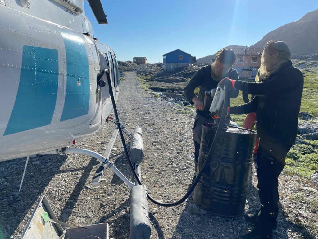
Sometimes unexpected things happen and you need to have plan B and sometimes C. On the last day we wanted to fly high up north along the margin of the ice sheet, which meant it was necessary to re-fuel the helicopter. We had planned for this at a small village with a heliport, but because of fog coming in late in the afternoon, the entire village was covered and we could not land. We therefore had to abandon our plan of going as far north as we wanted, and instead we had to deviate and land on a gravel road outside a small village where there would be a few barrels of fuel in a shed. We then had to manually pump in the fuel to the helicopter and even though the weather here was good, the enormous number of mosquitos, made it difficult to focus – but in the evening we all had a good laugh about this absurd and funny situation which none of us will probably ever be in again.
Overall, we had some very interesting and productive days in the field, where we collected a total of 11 sediment samples. I had hoped for 10-15 samples, so given the bad weather conditions, it was very successful fieldwork. Once we finished the three days in the field, we gathered all our samples, took pictures and packed them carefully before transporting them back to Denmark by ship. South Greenland is a very beautiful area and it was my first trip there. The landscape is very varied with large deep fjords, the margin of the Greenland Ice Sheet and mountainous landscape, especially in the far south. All that is left to do now is to wait for the samples to be processed in the lab and the isotope composition to be measured – only then will we know how successful this fieldwork really was.
Anne Sofie Søndergaard is researcher at the ETH Zurich. Her field trip took place in summer 2022 with financial support from a Polar Access Fund grant.
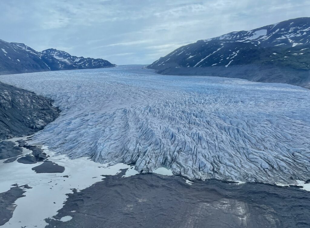
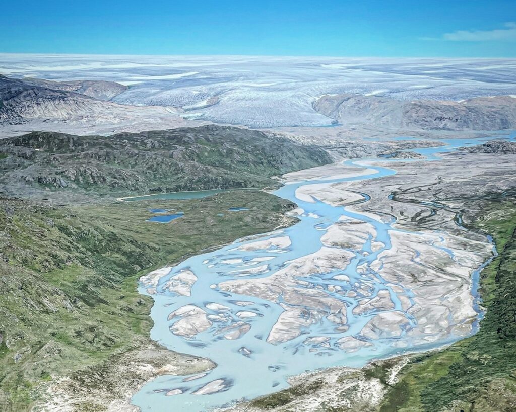
Header photograph: Flying in the helicopter gives you a spectacular view of the landscape and here we flew over a meltwater plain in front of the Greenland Ice Sheet, one of the most beautiful places we passed on our days in the field. © Anne Sofie Søndergaard, all rights reserved