Sometime last fall, I had a bad dream. I was visiting my field site, Portage Glacier, and checking on the instrumentation that I had – in real life – installed during the summer a couple months prior. In the dream, I took the field computer, plugged in one of the GPS devices, and … nothing. The folder of the device had automatically popped up as expected but it was empty. There was no data.
When heading into the field this July, I was cautiously optimistic that my nightmare would not be reality. But that’s the tricky part of fieldwork – you do your best, you weigh the options and make the best decision, and then you just hope. Hope that the bears don’t get too interested in your stations, hope that the snow load doesn’t rip everything apart, hope that the rodents don’t chew through the cables, hope that the sites you selected are protected from rockfall.
Last year, within the first six months of my PhD, we planned, permitted, and carried out a field campaign. From my office in Zurich, I had no idea what to expect of my first Alaskan fieldwork. I researched what to do about the bears, I looked at images from hiking reports, I considered the waterproof rating of my gear. I think anyone who has done fieldwork in a faraway place can relate – you plan, you study the aerial images, and it’s all completely different when you see it in three dimensions.
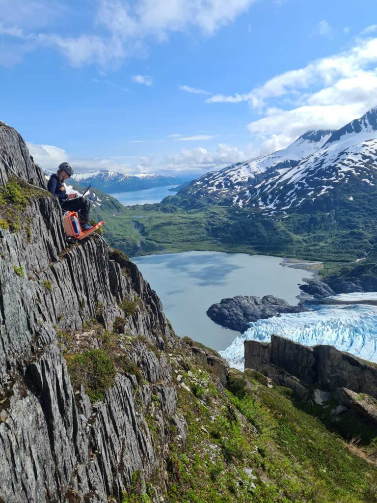
So when I was sitting – together with the technician who installed the instrumentation with me last year – on a steep grassy slope in the sunshine, eating gummi bears, and completely stunned and ecstatic that we had at least some data from all of our instrumentation, I was on top of the world, despite being only a few hundred meters above sea level. My nightmare was only a dream.
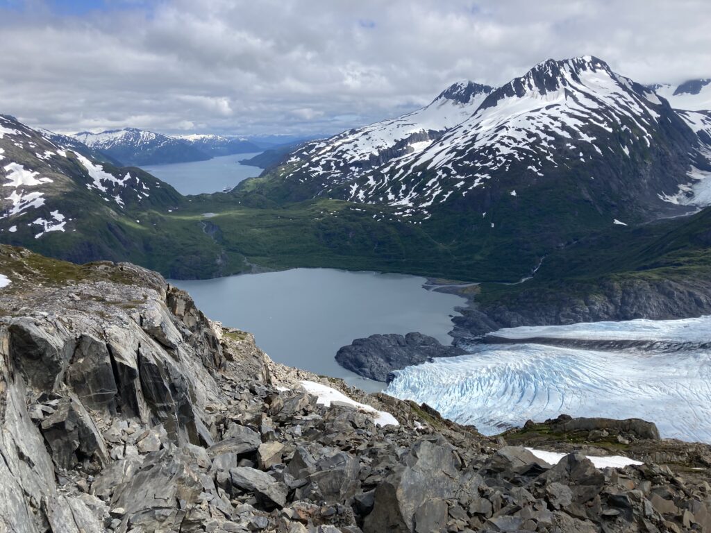
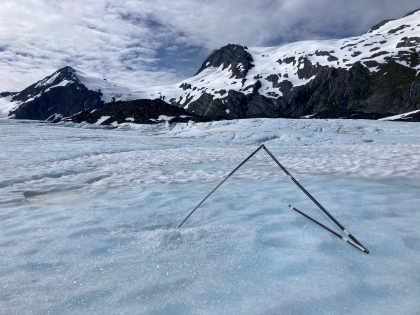
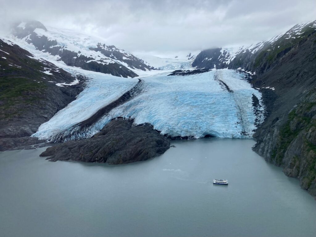
In the initial field trip, which took place in 2022, we installed 5 GPSs on the landslide, 4 ablation stakes on the glacier, and a time-lapse camera with an overview over both the landslide and glacier. All of the devices were permanent installations, meaning they would be there for multiple years, and data was saved locally. The goal with these instruments is to monitor a large landslide adjacent to Portage Glacier and how it is reacting to the glacier changes and other environmental factors, such as precipitation.
This site is especially interesting because the landslide is still bordered by glacier ice along its length, and therefore still receives some lateral support from it. However, with ongoing climate change, the support is rapidly changing as the glacier thins and retreats each year. Additionally, the presence of a popular proglacial lake make landslide-tsunami hazards a real and catastrophic possibility.
This year, with the generous support of an SPI Polar Access Fund, we returned to the same site, collected last year’s data, installed 6 geophones, and completed additional seismic measurements. A geophone is a device which transforms the signal of ground motion into a voltage. In our case, these operate at 4.5 Hz and were permanently installed at the field site. In order to capture lower frequencies, we also conducted measurements with 1 Hz seismometers, though these were only temporary installations.
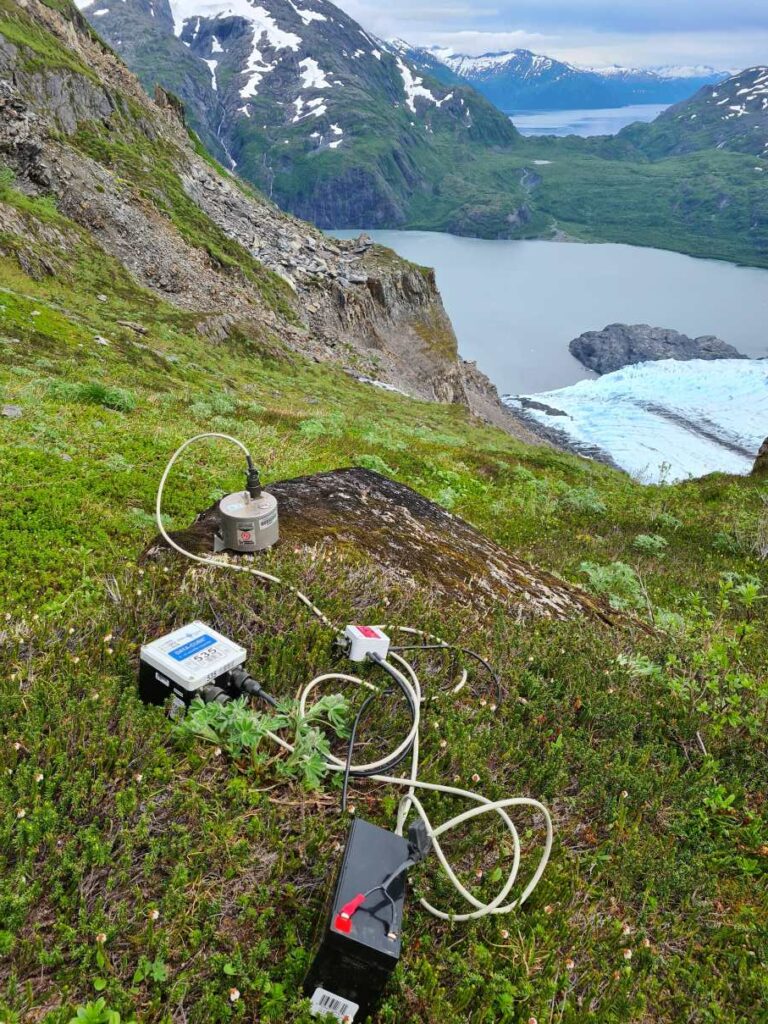
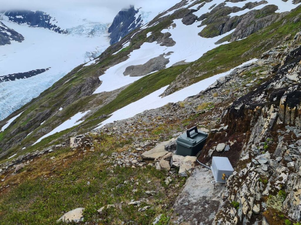
The addition of seismic instrumentation will allow for the determination of the extent of the sliding mass. In other words, we hope to be able to differentiate between the normal shaking of the ground, which may be due to earthquakes, storms, streams, airplanes, or other noise, and the rumbling due to the movement of the landslide mass itself. Knowing more precisely the extent of the moving area will inform hazard mitigation.
It will be some time before we’ll know if these latest installations will deliver reliable and sufficiently long datasets. We were already able to retrieve three weeks of data from the devices this summer, and we hope and expect that they are continuing to run throughout the next year. We plan to return to the site once again in early July 2024 to retrieve the data.
Now that the busy summer season is over, the fieldwork nightmares have already begun again. This time, it was about the time-lapse camera images being out of focus. Only time will tell if it was just a nightmare or foreshadowing reality. In the meantime, I’ll continue hoping that everything is running smoothly on that steep grassy slope in a faraway place.
Special thanks go to Raphael Moser, who oversaw the technical aspects of the installation and was in charge of field safety; Annegret Pohle and Romain Hugonnet for their field help; Bretwood Higman for field and equipment support, and valuable scientific input; as well as colleagues at the United States Geological Survey and the United States Forest Service for their assistance.
Jane Walden is a doctoral student at the Laboratory of Hydraulics, Hydrology and Glaciology (VAW) at ETH Zurich and the Swiss Federal Institute for Forest, Snow and Landscape Research (WSL). Her fieldtrip took place in summer 2023 with the financial support of a Polar Access Fund.