44% of Earth’s glaciers in high-relief mountains are covered by rock debris that insulate the ice from atmospheric forcing, reducing ice melt. However, as the debris cover is not homogeneous, space remains that produce differential melting under variable debris thicknesses, creating a surface morphology in the form of strongly incised supraglacial valleys typically observed on debris-covered glacier tongues. These supraglacial valleys are characterised by supraglacial channels surmounted by ice cliffs, whose links and formation processes are still poorly understood.
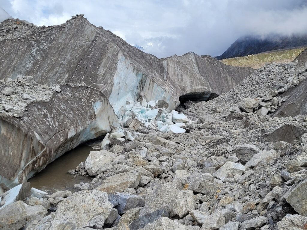
View of the research site where the structural instability of the ice cliffs is omnipresent
Satellite images of the Satopanth Glacier have been studied to map the ice cliffs on its surface. However, no fieldwork had been done to study the morphological evolution of ice cliffs and supraglacial channels on a local scale. This field campaign aimed to carry out drone flights, scans, time-lapses, and in-situ measurements of a representative site of the glacier. The purpose of these measures would be to determine and quantify the role of the supraglacial channels’ incision on the ice cliff formation and backwasting, as well as to identify and analyse the influencing external variables.
Our approach to the base camp was difficult with late monsoon conditions. Unfortunately, these conditions persisted and complicated our work in the field. However, we were welcomed by a Hindu monk who took refuge near a sacred lake, called Satopanth Lake, for six months a year. He lived on what he received from passing pilgrims and did not hesitate to offer shelter and food to those who wanted it. He suggested that we set up the base camp near his tin, rocks and wood shelter at an altitude of 4300m.a.s.l.
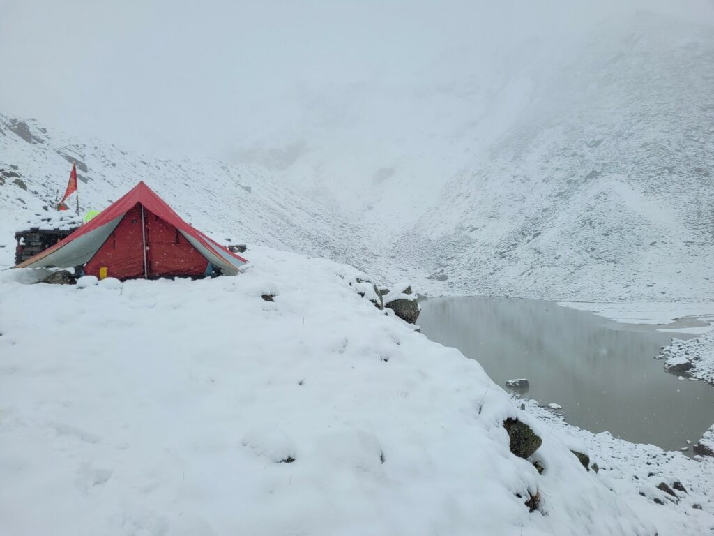
Part of our base camp near Satopanth lake, under winter conditions
Despite these sometimes daunting conditions, our research site was much more attractive than expected. The ice cliffs, equivalent to a four-storey building, were formed from unique stratifications, making this ice landscape breathtaking. The incision created by the supraglacial channels was so deep that we could go inside and scan right to the edge of the supraglacial channel: something inconceivable in many glaciers covered with alpine debris. If necessary, these incisions allowed us shelter from the rain.
These stratifications demonstrated how ephemeral the beauty of glaciers could be
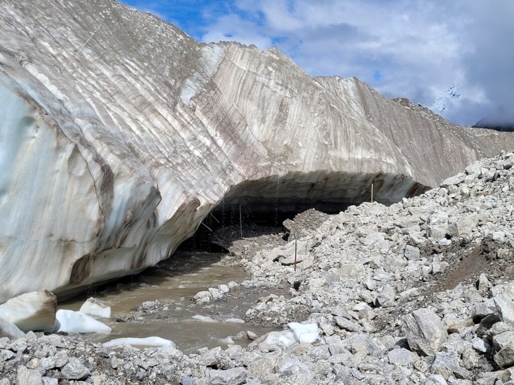
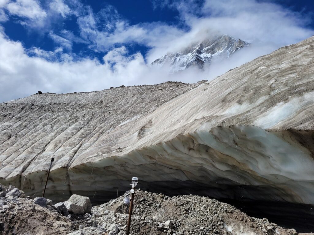
A weather station composed of an anemometer, an albedometer, a thermometer and a hygrometer was installed at the base of these ice cliffs to measure all the atmospheric variables, which could allow us to better determine the influence of external variables on this glaciological system.
Four time-lapse cameras were also installed at different locations on the site in order to be able to observe in real-time the behaviours and quantify the surface melting of the ice cliffs and the part incised by the supraglacial channels during these ten days of measurements.
A moment of blue sky after a heavy downpour is ideal for taking beautiful photos of the research site
A drone flight and twenty site scans were carried out daily over four separate days. These scans carried out at different locations on the site will then be aligned with each other to have optimal coverage of the entire site. Drone flights, allowing the acquisition of high-resolution images, will make it possible to fill in the potential “no data” on the scans.
Flying the drone and scanning the site at the right time was not easy in the weather conditions in which we were exercising. Moreover, even with the possibility of having daily weather reports, it was impossible to predict precisely how the day would go and if we would have the capacity to acquire enough data. Most of the time, we were lucky to have a few periods of calm.
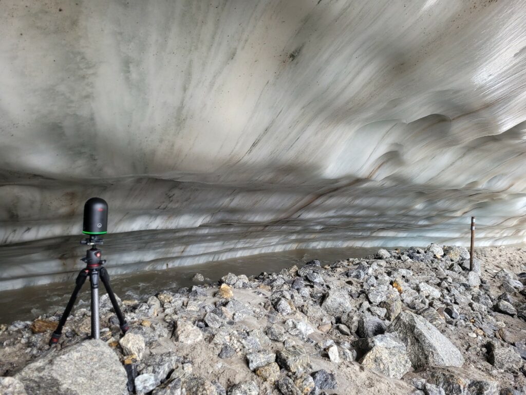
The laser scan in action in this fascinating and unique setting in the supraglacial channel incision
All the measurements undertaken at this site were successful, and the density of data acquired, despite the unstable weather conditions, is entirely satisfactory. According to the first estimates at our disposal, the melting of ice cliffs was about 2.5cm per day and 1.4cm in the incised part during ten days of measurements.
Paradoxically, the melting of the ice cliffs is a crucial element of the project to quantify and better understand the processes that allow the development of these forms, particularly the debris-covered glacier. This lack of ice melt will not impact the quality of the data collected, which is likely to be exceptional as it is unique in debris-covered glacier research.
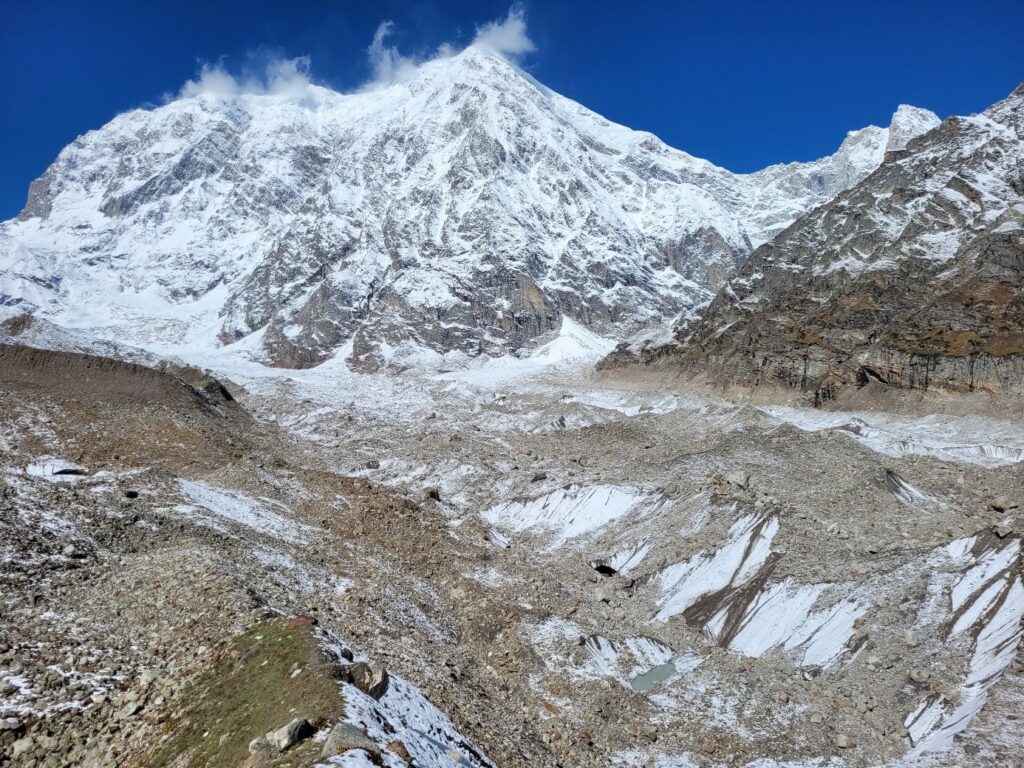
View of Chaukhamba, the highest peak in the Satopanth Glacier region, at 7138m.a.s.l (Chaukhamba I)
As a parting gift after so much effort and work, the last few days in the field were generously sunny: ideal for some impromptu hiking after dismantling our equipment on site.
Our departure from the camp was not without emotion, with the promise made to the Hindu monk at Satopanth Lake that we would probably return next year for further field measurements and communion with this breathtaking nature.
The process and analysis of these data are currently being developed, with the hope of obtaining results that will allow us to understand better the role of the supraglacial channels incision on the ice cliff formation and backwasting.
Boris Ouvry is an early-career researcher at the university of Zurich. His field trip took place in summer 2022 with financial support from a Polar Access Fund grant.
Header photograph: View of Chaukhamba, the highest peak in the Satopanth Glacier region, at 7138m.a.s.l (Chaukhamba I). © Boris Ouvry, all rights reserved