14.09.2022 – The protagonists
1936 – Arnold Heim and August Gansser
1939 – André Roch, Ernst Huber, Fritz Steuri, David Zogg
Six Swiss mountaineers, geologists, topographers. Pioneers who explored the hidden valleys of the Garhwal range of the Indian Himalaya more than eight decades ago. They made impressive first ascents, survived terrifying avalanches, and most interestingly, made some extremely accurate observations and photographs of the glaciers flowing down from these remote ranges. For a glaciologist, this data presents a unique opportunity to understand and quantify long-term glacier changes in a mountain range where such observations do not go back further than the 1960s. Simone and I are about to retrace the steps of these early expeditions, repeat their observations and take additional modern measurements of these glaciers which are strongly impacted by climate change.


19.09.2022 – Picardie weather in the Upper Alaknanda
The rain started as soon as we took our first steps on the approach trek, large clouds covering the great peaks. Very strange for the season, but it seemed that this year the monsoon had decided to extend its stay in the Upper Alaknanda. This felt like spending December in Picardie, at my grandma’s place. But instead of enjoying a good book and hot chocolate in front of the fireplace, we had to keep moving, packing and unpacking the camp every day, things getting progressively wetter and wetter. How does a glaciologist work when the glacier disappears in the fog? This is called ‘umbrella fieldwork’ – just make sure to keep the GPS’ tracking mode on if you want to have a chance to find your way back to camp…


20.09.2022 – Everything looks easy on Google Earth
This trip included a three-day foray up Bhagirath Kharak Glacier, one of the largest in the area, to climb a remote 5400 m peak where Gansser & Heim had camped and taken very valuable photographs of the upper reaches of the glacier. Modern technology makes the planning of such trips so simple. A few minutes of scrolling on Google Earth and we know precisely where we to camp, which route to take, where we to find water… on a glacier that has only been visited a handful of times since 1936. ‘See… it’s just 15 km, you walk around the moraine, take foot on the glacier, circumnavigate these ice cliffs and go up this ramp to reach first camp… easy!’ Easy? It’s always too easy to forget how difficult it is to navigate on a debris-covered glacier… and this one is probably the nastiest I’ve ever seen. Roller-coaster hills of unstable boulders, huge supraglacial lakes barring the way when least expected, nasty-looking moraines preventing any passage…


21.09.2022 – A lost bet
Two years ago, I started looking into this 1936 expedition to the Garhwal by Heim and Gansser, collecting data, visiting libraries to trace back the archives. This was the inception of this project, and already at the time I was imagining myself visiting the camp they had set up at 5400 m, high above these wide glacier extents. Then the COVID regulations came and went, we pushed our expedition plans back three times before finally being able to reach Uttarakhand. Even then, additional constraints (permits, access) threatened our venture up Bhagirath Kharak, but we remained confident. We spent a whole day travelling up-glacier, on one of the most horrendous terrains I have ever travelled – very loose piles of boulders of various sizes, abruptly cut by massive ice cliffs and supraglacial lakes. After circumnavigating the lateral moraine, we found a way up to a small plateau and set up camp. That was it, we were there, just a few hundred meters below the spot where Gansser & Heim had taken the pictures that we knew by heart now after looking at them in the tent almost every evening. At this point I was sure we would succeed. Alas, when waking up at the strike of dawn, we were greeted by the familiar sound of rain on the tent canvas. As we scrambled up the mountain slopes, this rain turned to snow and the clouds swallowed us. Retreat was a difficult choice to make despite being the only reasonable option. Walking back down felt like a defeat, even though I knew that all the other measurements we had taken already guaranteed the success of our fieldwork.


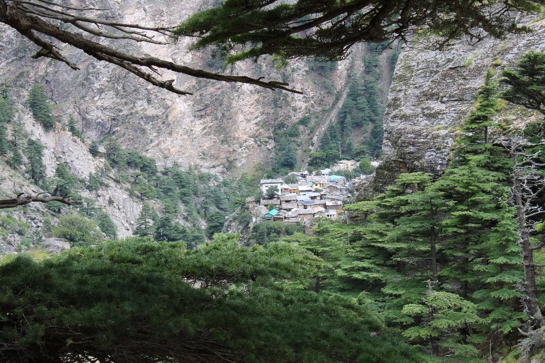
23.09.2022 – A place out of time
R… village, a few hours’ drive from Josimath on a difficult road regularly swept away by landslides. We have been sitting for a few hours now in the central square of this village of a few hundred inhabitants. We are waiting for our guide, a young villager who has spent his entire life in these mountains. He remains there when the villagers go down to their winter quarters near Josimath, the only living soul in this remote valley for half of the year. Tales say that he knows the mountains like the back of his hand and runs like a mountain goat on their steep slopes. While we are sat waiting, some of the elderly villagers have gathered, chatting with our porters, keeping an eye on us – no westerner has set foot here in the past 20 years. A few kids appear with some makeshift toys and start playing. The mountains tower above us, filled with bird songs and the chatters of the villagers going to tend to their fields. Someone brings us a cup of butter tea, then a glass of rakshi, the local rice alcohol. Soon we are invited to have a plate of dal bhat, and it tastes delicious. The sun appears between the clouds for a few minutes, shining on the peaceful place, away from the world. I think I could stay here forever.
29.09.2022 – Data, data, data!
It has rained and snowed continuously for the past five days, and the heavy fog rising from the valley has made our excursions on the glacier from camps feel like proper adventures. But at last, the sun has returned, chasing away the monsoon clouds. Suddenly, we can leave the tents without an umbrella, suddenly everything looks possible, suddenly we realize that there is still so much data that we want to collect. A few minutes after breakfast the drone is already buzzing above the glacier, I am running across the debris to measure the position and melt of my ablation stakes, Boris is in the ice cliff channel taking his first scans of the day. The cook knows that we won’t reappear at camp before dark and sends some porters to our study locations with some cold lunch. It is delicious but we can only afford a few minutes to swallow it. The time-lapse camera needs to be downloaded, more drone surveys need to be conducted, debris pits need to be dug… A day like today is pure joy for a scientist, and we’ve waited almost two weeks for it!


Marin Kneib is an early-career researcher at WSL. His field trip took place in September 2022 with financial support from a Polar Access Fund grant.
Header photograph: © ETH-Bibliothek Zürich, Bildarchiv