A dream come true – after months of preparation and intense exchanges with Benjamin V. Gaglioti and Margaret M. Darrow from the University of Alaska Fairbanks, my trip to the last frontier finally started in May 2023.
A few days in Fairbanks first, a big shopping trip to one of the major food stores, extra tough rubber boots for the swampy field, a heavy truck full of non-perishable food, field equipment, bear spray and a set of chainsaws. Off we go to the Dalton Highway, heading north to the Brooks Range.
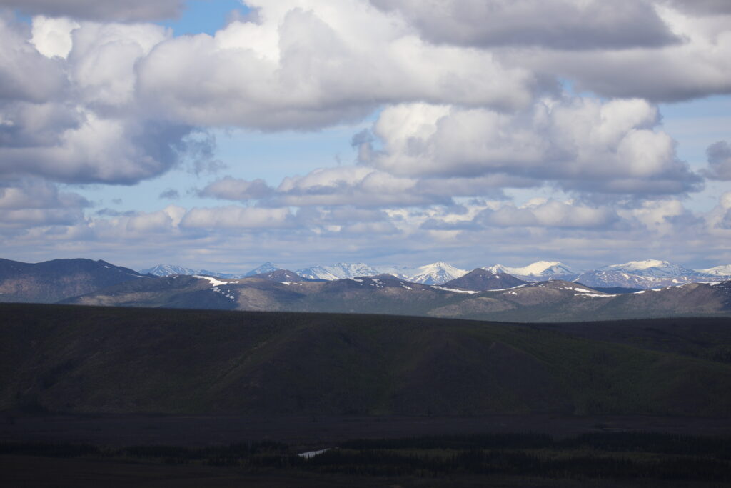
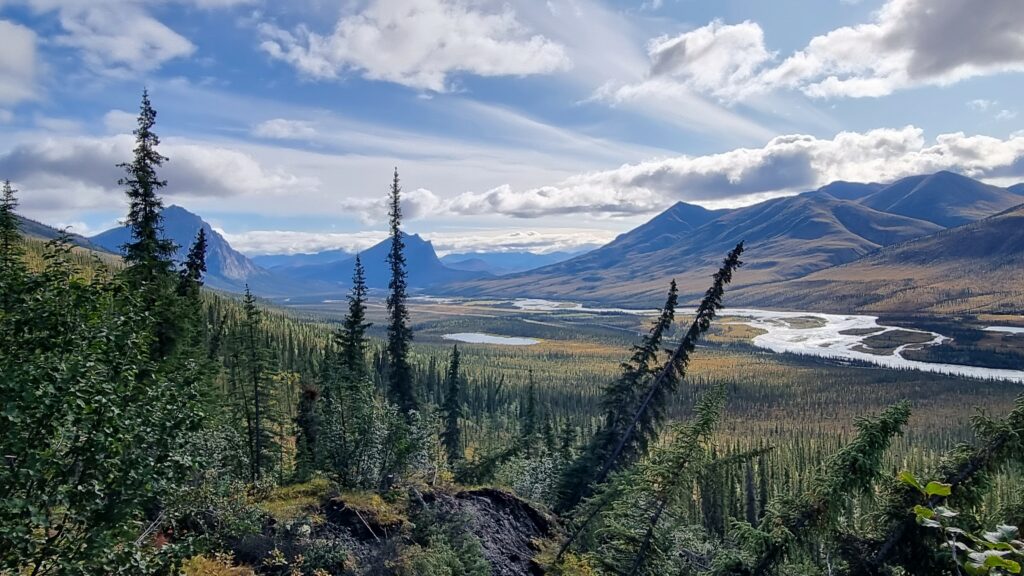
Travelling from Fairbanks to the Brooks Range along the Dalton Highway is an experience of its own and a dive into the Alaskan wilderness. Some even refer to this dirt road trip as to one of North America’s most dramatic overland adventures. After 8 hours in the truck and numb legs, I must confess that the drive was both impressive and exhausting, but also a spectacular introduction to boreal forest, tundra, and Arctic mountains.
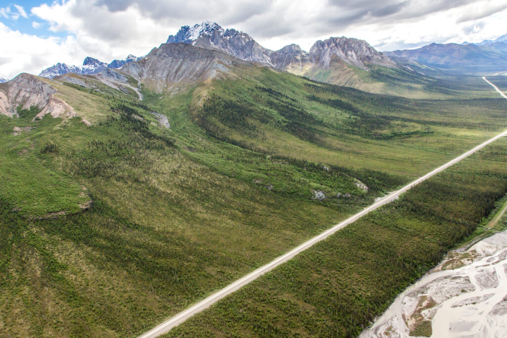
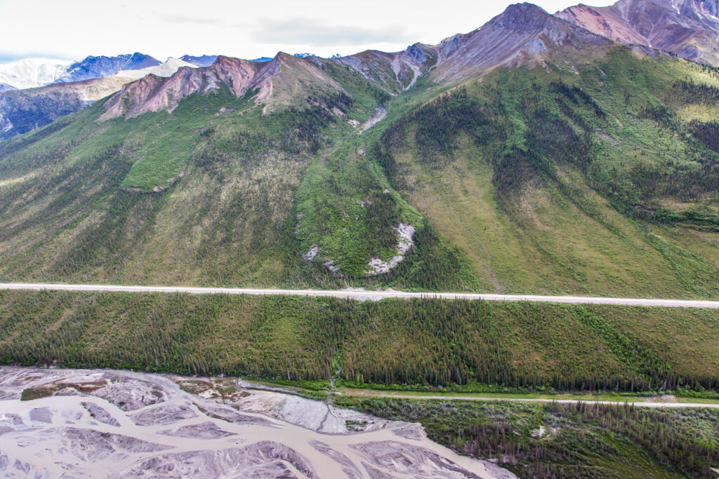
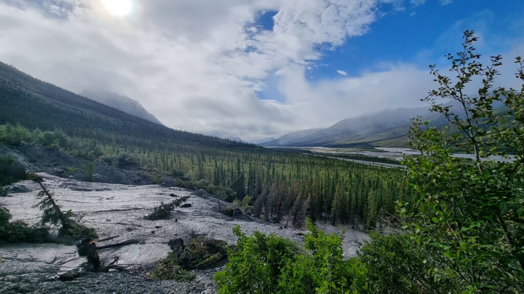
Originally constructed in the 1970s to support the Trans-Alaska Pipeline System, the Dalton Highway connects Livengood (north of Fairbanks) with Deadhorse, near Prudhoe Bay on the Arctic Ocean. The dirt road is often dubbed the “Haul Road” and is still primarily used by trucks transporting supplies to oilfields. The dirt road also crosses the Brooks Range, the northernmost mountain range in North America extending over 1000 km across northern Alaska. The range also marks the beginning of a zone of increasingly active permafrost dynamics – and it is here that Frozen Debris Lobes (FDLs) become a critical focus of both scientific interest and concern.
These fascinating, slow-moving landslide-like masses of soil, rocks, trees, and ice are also the main reason why we made it all the way north. Driven by permafrost thaw on hillsides, these FDLs are on the move above the Dalton Highway and the Trans-Alaska Pipeline System. Compared to their “relatives”, the rock glaciers, they are quite impressive: Oftentimes 100–500 m wide, 20–50 m thick, extending downhill for up to 1000 metres or more, they move at rates of more than 2 cm per day and up to several tens of metres per year. FDLs are not just geomorphic curiosities; they also present a real threat to infrastructure. FDL-A, for instance, the most studied lobe, has now reached the Dalton Highway and is getting closer to the pipeline.
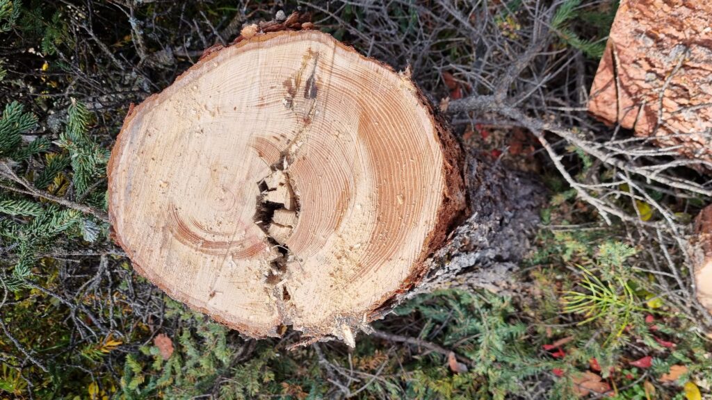
And here we are now, at the foot of FDL-A, our first candidate to be analysed. After a first night in the rustic, but comfy cabin at Wiseman – with just the drowsy sound of the nearby creek and some wolves howling in the distance, we start our exploration of FDL-A and its century-old white spruce trees surfing on it. Alerted by fresh grizzly scat and footprints, we only slowly trudge through the deep mud and dense brushes to explore the study site. We were visibly loud enough, no bears or other carnivores around today – thankfully. One less concern on these demanding geomorphic features. More excitingly though, we quickly realise that the sites we proposed in the SLIPPERY SOILS project have much more potential than we were hoping for: Leaning in all directions, with split trunks and exposed roots, the white spruces are excellent candidates for the assessment of past and current episodes of FDL movement, and for the search of causal linkages between climate change and soil (in)stability. A few days later, and after having explored other FDLs, we have a plan to study the dynamics of these mysterious giants.
In the meantime, Mattias Coullie and Sébastien Guillet from the University of Geneva have joined the field team. After a tasty Alaskan lumberjack breakfast with eggs and pancakes, we are ready to go sampling trees on the FDLs and we head north from our cabin basecamp along the Dalton Highway. Unlike in the Alps, where we normally work with increment cores, we were granted permission to work on full cross-sections of trees to identify different episodes of tree leaning and hence phases of instability better. Equipped with large pack racks, chainsaws and fuel, we go back to the selected sites and start sampling trees along predefined transects. After a full week of work, reams of blisters, hurting backs and clothes full of resin, we return to Wiseman for a last night before heading back to Fairbanks with more than 300 samples of “drunken” white spruce trees and the certainty that these poor trees growing in miserable conditions will tell us interesting stories about the impacts of climate change on permafrost thaw, slope instability and on why and where FDLs could affect infrastructure in the Brooks Range and beyond.
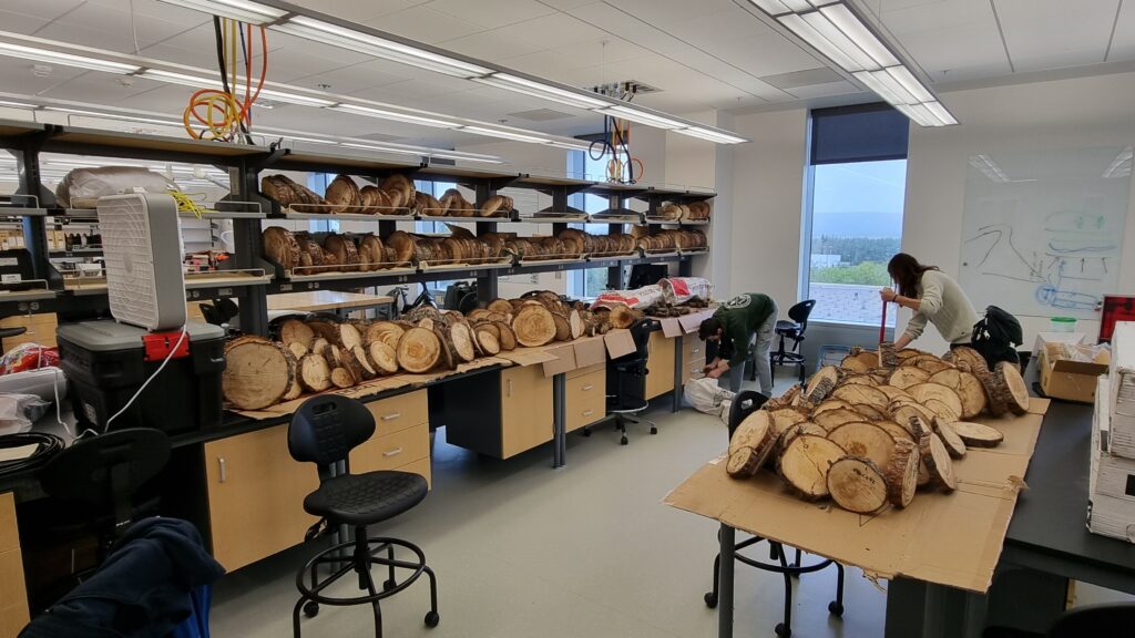
In retrospect, the Exploratory Grant allowed me to explore the Alaskan Arctic in a way that would not have been possible without the support of the Swiss Polar Institute. Ongoing analyses provide invaluable insight into when and how the landslide-like features moved in the past, and what keeps them sliding down hillsides today. Extending this story back for centuries and putting current instability into a longer-term perspective provides unprecedented, annually resolved data on how the Arctic has changed and is still changing. Last but not least, this first experience in the Brooks Range also laid the ground for a much larger grant from the Swiss National Science Foundation and more fieldwork and research on FDLs until 2029.
Markus Stoffel is Professor at the Section of Earth and Environmental Sciences at the University of Geneva, Switzerland. His fieldtrip took place in May 2023 with financial support of an SPI Exploratory Grant.